Trona on the Web: SVHS Brochure
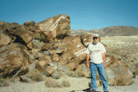
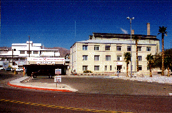
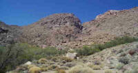
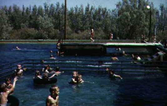
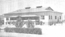 Clubhouse -- Photo by Unknown Approximately 1945-1955 The following information is from a brochure of the Searles Valley Historical Society. Be sure to pick up something from the Gift Shop when you visit the museum. OLD GUEST HOUSE MUSEUM13193 Main Street Hours: MONDAY, WEDNESDAY, THURSDAY, SATURDAY– 9am-Noon TUESDAY, FRIDAY – 10am –1pm or By Appointment (call) (760) 372-4800 (760) 372-4884 (760) 372-5230 (760) 372-5885 (760) 372-5064 (760) 372-4600 HISTORY HOUSE83001 Panamint Street By Appointment Only SEARLES VALLEY POINTS OF INTEREST SALT WELLS CANYON(POISON CANYON) This canyon commonly called "Poison Canyon" because surface water usually present in the upper part of the canyon was believed to contain poisonous chemicals. The rock-walled canyon was carved originally by the Owens River when that river flowed into Searles Valley at the close of the last two ice ages. When traveling west through the canyon, at one point on the north wall an outline of the rocks closely resembles the profile of Abraham Lincoln.
When traveling east, a rock formation resembling fish may be seen. These rocks were originally known the "Whale Heads" but the name later changed to "Fish Head Rocks". A few Indian petroglyphs are located in one of the canyons. TRONA PINNACLES
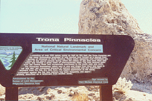
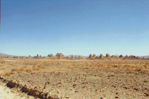
A spectacular group of calcareous tufa towers located in the southwest corner of Searles Valley. This National Natural Landmark is about 12 miles south of Trona and is accessible via a 5-mile dirt road (not recommended in wet weather) from the end of State Highway 178. The Pinnacles formed in the ancient Searles Lake from upwelling ground water. MAGNESIUM This siding on the Trona Railway about 1 mile southeast of the end of State Highway 178 (and on the road to the Pinnacles) is the site of the terminus of the Magnesium Monorail road which ran from this point across the Searles Lake to haul Epson salt from a deposit 14 miles south/west of Death Valley. This unique monorail system was abandoned in 1926 after having been in service for about two years. from more about the monorail go to: Epsom Salts Monorail Rail Road PicturesTRONA, CALIFORNIA
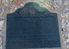
Trona, California is located in Searles Valley in the northwest corner of San Bernardino County and is adjacent to Inyo County on the north, Directly west of Trona about 15 miles, is the Kern County boundary. Historically Trona is near the old Jayhawkers Trail leading out of Death Valley, and is geographically in the Greater Mojave Desert. SEARLES LAKE BORAX DISCOVERY
California Registered Historical Landmark No. 774. The landmark reads as follows: Borax was discovered on the nearby surface of Searles Lake in 1862. With his bother, Dennis he formed the San Bernardino Borax Mining Company in 1873 and operated it until 1897. These chemicals in Searles Lake which include borax, potash, salt cake and lithium were deposited here by the runoff waters from melting ice age glaciers. John Searles discovery has proved to be the world’s richest chemical storehouse, containing half the natural elements known to man. Plaque placed by the Death Valley ‘49ers. Inc., the American Potash & Chemical Corp., and the West End Chemical Division of Stauffer Chemical Corp. November 8, 1962. INDIAN JOE’S CANYON
A large spring in a canyon about one mile south of Great Falls. Not accessible by car. John W. Searles planted a garden and fruit tress at this spot and named it Indian Joe Spring. The Produce was intended to help feed the workers at the borax operation on the Searles Lake. Some of the fruit trees and grape vines still grow there. VALLEY WELLS State Registered Landmark No. 443. The landmark reads as follows: In this area, several groups of Midwestern emigrants who had escaped from hazards and privations in Death Valley in 1849 sought to secure water from Searles Lake. When they discovered its salt nature they turned north and westward in despair and with trial crossed Argus and other mountains to reach settlements on central and southern California. This Historical Monument was placed by the Trona Lions Club and dedicated in June 1982. GREAT FALLS CANYON GREAT FALLS CANYONAn intermittent stream, from springs on the east side of Argus Peak, tumbles over rocks and a cliff about 25 ft. high at this point. The flow of water generally diminishes to a trickle in the fall and early winter.
A desert mountain residential community about 10 miles north of Trona in the Argus Mountains. Yards and gardens are watered from local wells.
The historical Ruth mine, at the end of the paved road through the canyon, is an inactive mine which operated to World War II.
SLATE RANGE CROSSING This point on the Trona-Wildrose road affords a magnificent view of Panamint Valley
and the Panamint Mountains, including 11,049 ft Telescope Peak, generally covered with
snow in the winter an spring. From this point the old stagecoach and wagon road built in the late 19th
century by Remi Nadeau, the top freighter of the Panamint Valley as well as other areas,
can be still be seen where it winds through the hills and heads straight across the
Panamint Valley.
HISTORICAL SOCIETY The Searles Valley Historical Society was
organized in 1979 as a non-profit corporation. Its primary purpose is to bring together
people interested in history, especially in the history of Searles Valley and to preserve
the history of Searles Valley for future generations. The Society publishes a quarterly newsletter "The Ol' Timer", sent to all
museum members.
HISTORY HOUSE One of the oldest residential houses in Trona (built around 1920) located at 83001
Panamint Street. In 1986, Kerr-McGee Chemical Corporation, the resident chemical company,
donated the house to the Historical Society. With the acquisition of this property, the
Historical Society really began to flourish. Caboose - In the lot adjacent to the house is the "Trona Railway"
caboose. Built in 1958, this caboose was acquired from the Trona Railway in 1993. OLD GUEST HOUSE MUSEUM
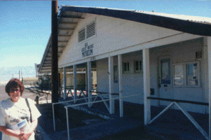
This building was built around 1912 and is one of the oldest buildings in Searles Valley. It was originally built as 4 apartments; then remodeled into a guesthouse with 12 rooms for visitors to Trona since there was no housing. The building has been remodeled several times since with the addition of evaporative coolers and gas heaters. Originally it was heated with steam from the Chemical Plant.
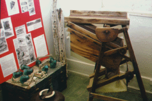
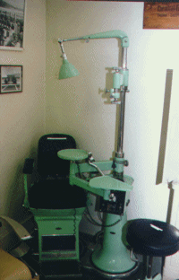
In 1991, North American Chemical Company donated the building at 13193 Main Street to Historical Society, which we named the "Old Guest House Museum". There are 8 rooms designated to show events in Searles Valley from early mining days (changes in plant ownership) to current day. The activities and organizations of the residents are reflected here also. There is an excellent source of information for research in our file room.
The chemical companies or residents and friends of the museum donated all display items. The museum is open to the public and tour groups are welcome. New members are also welcome and dues are $15.00 per family per year. Life membership is $200.00 dollars. Donations from visitors are appreciated but not required. Last Update: 02/23/2014 |
||||||||||||||||||||||||||||||||||||||||||||||||||||||||||||
