Trona on the Web: Searles Valley Mines
RUTH MINE
This mine is located about 12 miles northwest of Trona in Homewood Canyon at an elevation of 4000 feet. The mine operated from about 1899 to 1942. the ore was free gold associated with pyrite in iron stained quartz monazite. The mine produced over $500, 000 worth of ore.
GOLD BOTTOM
About 9 miles northeast of Trona on the west slope of the Slate Range at an elevation of 2500 feet. The mine was discovered in the 1880 and operated until 1937. The mine is said to have produced $1,000,000 worth of ore. Other names for this mine were Copper Queen and Slate Range.
MOHAWK MINES
About 8 miles north of Trona and 2 miles southeast of Ruth Mine. It was discovered in the 1900's and was shut down in 1942.
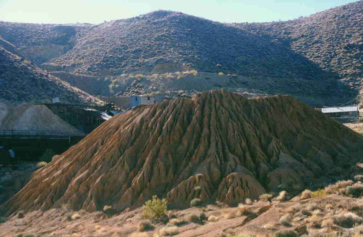
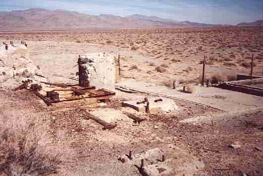 Photo by Larry June April 2002 |
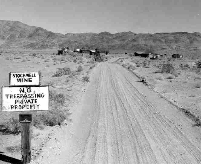 |
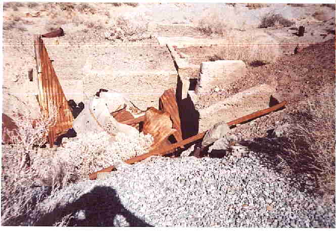 Photo by Larry June April 2002 |
Ten miles northeast of Trona on the west slope of Slate Range. The elevation is about 3,000 feet and is three miles northeast of the mill. The type of ore is gold associated with pyrite, 2% copper. The discovery was about 1897. This property was acquired by B. P. Greenleaf and Billey Norvell early in the 1920'S. In 1918 they organized a company with Vernon E. Stockwell. In 1924 Mr. Ed Teagle bought the property from Stockwell Mining Company for $100,000. From 1924 to 1933 little besides assessment work was done. In 1933 mining began and between 1933 and 1936, 22 men were employed.
In 1941 a new mill was erected but the mine was closed by the war production board in 1942. In 1950 the mine was rehabilitated and there has been activity at the mine from then until at least 1975.
SLATE RANGE QUARTZ MINE
If you take the lake road that starts at Yucca Street across Searles Lake to the foothills of Slate Range you will find a canyon just east of intersection with the dirt road that runs north and south. It may not be apparent from the road because the base of the range at that location is almost dune like.
In 1960 a friend of mine were attracted to the spot by the site of several bright orange plywood targets that the Navy used to tow behind aircraft to use for target practice. This was going to be the source of plywood we needed for our science project. That is until we found out how heavy they were and how deeply the noses were buried in the sand from the hard landing they had. By the way, this area is off limits so contact the Navy before you decide to venture into this part of Slate Range. There may be more than targets buried in the sand!
As we went further up the hill, in hopes to finding something that was a size we could manage, we spotted a small shack, about the size of an outhouse. Upon closer look we found a paper note nailed to the door that said, "Come on in out of the sun and help yourself to the water. You'll find us up at the mine." We didn't find any water and the only thing in the shack that would have held water was a small shoot glass.
Anyway, this was enough to get curious and so we ventured further up the canyon. What we found was a wooden mining cabin that looked liked whoever left had planned to be back soon, either that or they took everything they thought had value and left the rest. The cabin had a pantry with a shelf that was still stocked with food. I'm pretty sure that no one had used this camp since at least 1935.
I don't remember all the details but what I do remember were items that you might find in your own kitchen cupboard even now. There was a can of tuna, part of the can was rusted away but you could see the tuna through the holes. Still in the same shape it was in the day it was canned, only by now it was turned to black carbon. There was a can of beans that had rusted through, the beans were still there but as hard as stone.
Also on the shelf was a jar of peanut butter. The lid was still on it and was still in good shape. For some reason it held out better than the metal of the cans. We could see the peanut butter through the glass. It was a bit faded but still brown. I wish now we hand opened it but at the time I was expecting a horrible smell so I think we left it be.
We also found a Sears catalog with some terrific bargains in it, that is, if the items could be purchased with today's dollars. It was dated 1933.
Up the hill from the cabin we found the mine. It only went back into the hill a few feet. At one time it may have been deeper and caved in or maybe the price of quartz changed or the mine gave out. There were rails and a mining cart so who knows.
Above the mine, at the top of the ridge, we found the claim marker. Buried in a pile of rock inside a tobacco can was a note that described the claim, what they were mining for and the names of the claim owners and the date of about 1932-34. If the site had not been on Navy property I'm sure it would not have been so well preserved.
Funny how after 41 years I still remember all these details. If anyone has ever gone back I'd like to hear if anything is left. Unfortunately people like to tear things up and haul things off.
Other mines in the valley include Davenport Mine, Orondo, St Patrick, Veta Gold, Stone Cabin, Borosolvay Quarry and West End Quarry.
The information on the page was obtained from California mining records and other sources in the public domain. More detailed information about these mines and other Trona topics can be found in Trona Trivia by Dr. O.N. Cole. which was written in about 1984. This book is available for sale from the SVHS or may be borrowed at your local library by having them look it up on WorldCat and then having them contact the San Bernardino County Library System or other library that owns this title. Another source of information about Searles Valley mines. Another source of information on mines in Searles Valley is Searles Valley Story published in 1975 and is out of print. There are 10 libraries around the country that own copies of this book and it may be borrowed through libraries that participate in the inter-library loan program.